38 - Race Tracking and Protests
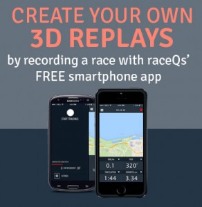
As technology evolves protest hearings are evolving as well. If you plan to use a raceQs' GPS track at your protest hearing, be armed with all the facts. Since most cell phone GPS positions aren't perfect, you can expect a geographic position variation of +/- 3 meters. Watch the video to learn more about the best way to present your case.

Do you love boating as much as we do? You’ll get even more enjoyment this year with Navionics Boating, the best app for on-the-water activities from the leader in location-based services! Download the app for FREE on iPhone, iPad or Android! Open to begin exploring on government charts for the US, included for free on iPhone and iPad and soon on Android. Then start to plan your routes, measure distances, or check wind forecasts. Record data during your next outing – tracks show the distance, speed and duration of your trips. Add markers to key fishing areas you want to target or tag the spot where you landed the big one! You’ll be able to save your routes, tracks, markers, and photos to share with your friends on Facebook, Twitter, or via email. At any time, purchase the chart coverage area you need for anywhere in the world, and get the same detailed charts found on plotters. Then access a boatload of georeferenced content including the largest database of POIs, in addition to valuable contributions made by other users in Community Edits ranging from hazards and temporary nav aids to prime fishing spots and more. Get the most out of the app by tapping into great advanced feature upgrades available In-App. On iPhone, iPad and Android transform the map’s display with Advanced Map Options. Or get detailed route planning, a suggested course for a trip, map updates and incredible HD bathymetry maps for iPhone or iPad! Download Navionics Boating now, it’s FREE!


Come Hang Out With Us


Jim Clark-Dawe said on October 17, 2016
I want to thank you for the incredible podcasts you’ve been doing.
I’m a moderator on SailX, a computer simulation of sailboat racing. Not only do we have an on-the-water umpire, but we have a protest room, to deal with situations where the umpire is wrong (rumor has it that he drinks) and where the umpire doesn’t call something.
Needless to say, we have a lot of protests about entry into the zone and who has an overlap. We’re frequently able, because of what is in effect GPS tracking, to ascertain exactly when the overlap is established in comparison to the zone. (Visit SailX and go through the protest room and look at some of the protests and you’ll see exactly what I mean.) We rarely have to resort to Rule 18.2(d).
Personally I believe the Hex Press has an overlap. Angles are hard to judge in photos, but you can observe some signs that Tru Viste is at more of an angle than Hex. Tru’s jib is more obscured, we can see Tru’s transom, and there are some smaller indicators that indicate a bigger angle on Tru compared to Hex.
The chances of a protest committee understanding this are not very high.
The GPS track is useless in this type of situation. What matters here is where the tracking unit is placed in comparison to the bow. Where you suggest placing the tracking unit is probably not where most of them go. I doubt that mine is anywhere near the center of the boat as measured front to back. (Side to side it’s fine.) Factor in the GPS error measurement (5 meters is probably accurate.) and you’ll see why you can’t use the GPS track in this type of situation.
The angle shown on raceQs is also very questionable. Proper placement is essential and goes downhill from there. Error factor in the GPS makes this next to impossible to accurate determine.
Yet raceQs and SailX can help us figure out the situation and make us know what to look for and say in the protest room. Starting point is that Tru has overlaid the mark. This means that Tru has two choices in rounding the mark. Tru can go wide and maintain the same distance from the mark that he was from the lay line. More likely, Tru is going to turn to pass the mark as close as he can.
This is what we’re seeing on SailX and what you see in this podcast with raceQs. Tru is clear ahead until he turns his boat. Once he turns the boat, the angle of his transom changes and suddenly Hex has an overlap. This is what Hex’s skipper is recognizing but doesn’t know how to present in the protest room.
But once you understand the dynamics, you know how to present this in a protest room to stand a reasonable chance of prevailing. The emphasis has to be on Tru’s change of course, right as Tru is entering the zone. This suddenly changes Tru from clear ahead to outside overlapped. But the emphasis has to be on the change of course and how that changes the angles between the two boats.
What I’ve learned on SailX is that you have to know when to make that change of course, depending upon whether you want an overlap or not. RaceQs will also help sailors begin to understand this dynamic. It makes logical sense, but it’s not something we realize is happening in a race, unless you know what you’re looking for.
As I said, I’m impressed with raceQs. I think it has helped my sailing and cuts down on our ability to lie to ourselves.
Jim Clark-Dawe
jimclarkdawe@yahoo.com