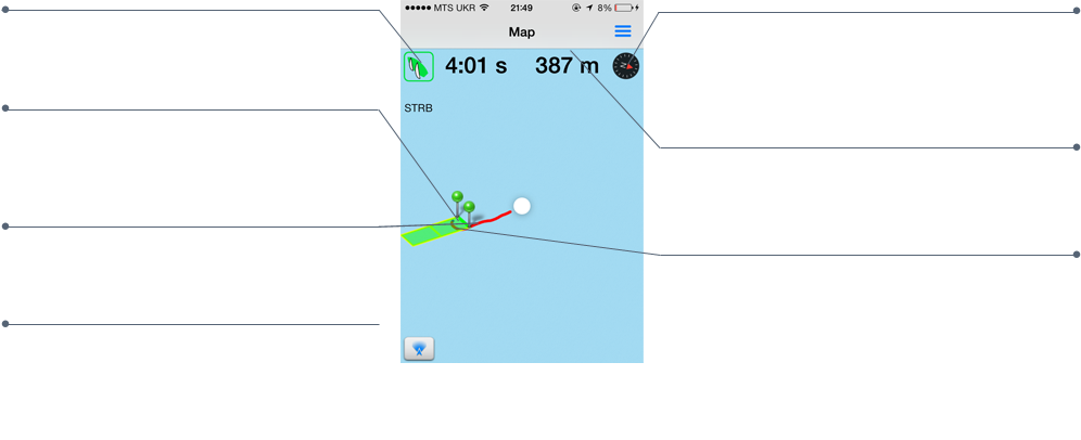
TACK APPROACHES
Press this icon to view port or starboard tack approach Laylines.
STARTING LINE
Location of the starting line.
TRACK
Your track for the last ten minutes is color coded to indicate changes in your speed that affected your performance.
LAYLINES
Shows the port or starboard tack Layline to the Pin, and Race Committee Boat.
CENTER
Push the target to center the map onto your boat's current position.
DISTANCE MARKERS
Indicates your predicted distance from the starting line at thirty, and sixty seconds based on the benchmark port or starboard tack speed you set.
GREEN STARTING GRID
You must complete the starting benchmark sequence to use this feature. Once complete, the starting grid will appear on your map.